|
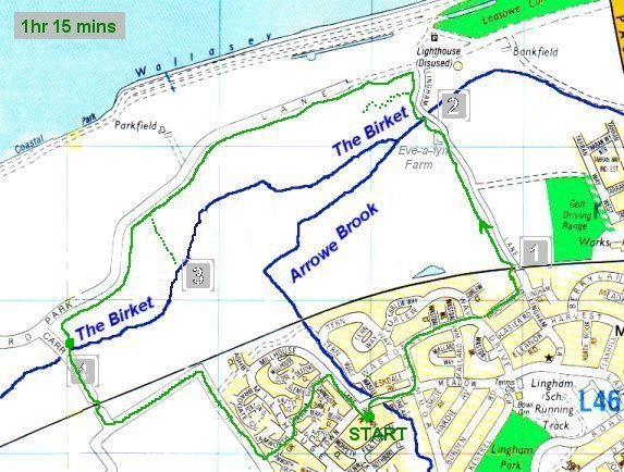
I was hoping to see the point where the Arrowe Brook joined The Birket so I set off for the nearest
pedestrian bridge over the railway. Point 1 on the map. The green line shows the path I took and the time for the round trip
is shown at the top left. The dotted green lines show a couple of 'detours'.
|
|
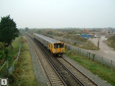
I headed north along Lingham Lane (more a dirt track, really) and passed Eve-a-lyn Farm hoping to catch a glimpse of the
Arrowe Brook from the bridge. Unfortunately, all I could see was The Birket and, as the land belongs to the farm,
it was unlikley I'd see where the streams join. What did strike me immediately, though, was how free of reeds and other debris The Birket is compared with stretches of Arrowe Brook that I'd seen so far.
|
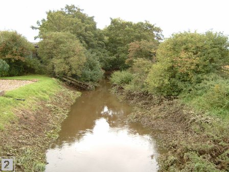
 Slightly further on, a footpath heading west was signposted. Although it looked as though I might be able to see the streams' junction,
I found a well-maintained pond that I didn't know existed and lots of tributaries feeding The Birket but not the
elusive junction!
Slightly further on, a footpath heading west was signposted. Although it looked as though I might be able to see the streams' junction,
I found a well-maintained pond that I didn't know existed and lots of tributaries feeding The Birket but not the
elusive junction!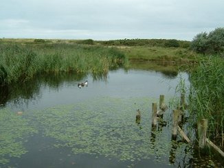
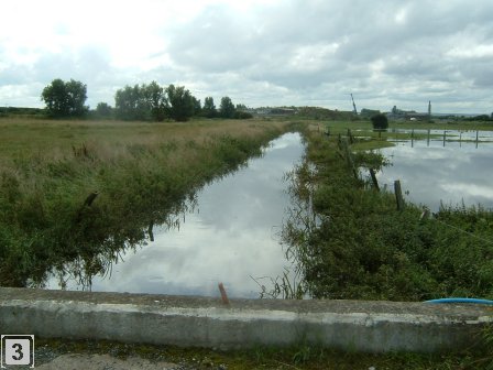
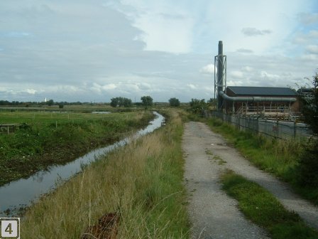
I continued westwards. Picture 3 is taken looking west. I was actually on a farm track but I'd misread the map! Picture 4 was looking back (towards the picture 3 location). Again, I was impressed with how clean the Birket looked compared with Arrowe Brook.
The chimney on the right of the Birket in picture 4 is part of a water treatment plant and you can just see Leasowe Lighthouse as a tiny white speck on the horizon towards the left of the picture.
|
|
The railway crossing just after point 4 on the map, is mainly unmanned. Pedestrians need to open a gate and cross with care. For the occasional vehicle, a gatekeeper lives nearby who you need to contact.
There's a car park near Leasowe Lighthouse (point 2 on the map) so I decided that, on my next trip, I'd park at the Lighthouse and head off east!
<< Back | Pasture Road to Bidston...